On a mountaintop in Surry, New Hampshire, above the Ashuelot River, a large flat boulder sits in a clearing. Pecked and hammered into the surface of the stone is the image of a curved bow, with the bowstring drawn back into a sharp V and a three-feathered arrow, aiming southeast. Below the bow is a grid of three long horizontal lines, crossed by three short vertical lines, tilting in the direction of the arrow.
Marge Bruchac Sokoki Homeland from Monadnock: K’namitobena Sokwaki, 2006.
The origin of this provocative wonder is, by nature, uncertain. Some believe it was carved by the original people of this land – the Western Abenaki band called Sokwakiak (or their ancestors). This southernmost group of the W8benakiak, people of the Dawnland, have inhabited this New Hampshire region of mountains, rivers, and lakes for time immemorial, a part of their homeland known as N’dakinna. Others have said the image is the more recent historic work of a Surry farmer named William Mason, which seems odd at the least. Anthropologist and historian Marge Bruchac makes further reference to historian Samuel Wadsworth’s account which seems to qualify the site as pre-dating the European presence in these hills, well before Mason.
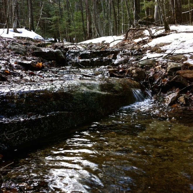
Spring runoff courses down the granite bedrock of the trail.
The last signpost to the peak.
Arrow Hill lies in the extreme southwest corner of the heavily-forested Cheshire County town of Surry, northwest of its better-known neighbor of Keene. It is a part of the Indian Arrowhead Forest Preserve, held by the Society for the Protection of New Hampshire’s Forests. The poised arrow etched into the boulder’s granite face points almost due southeast. I have heard that many hills in southwestern NH have such carvings, all directed toward a very special place, Mount Monadnock; I don’t yet know whether this is true. There is a line of sight cleared toward the prospect (although now overgrown) and in the winter you can see that singular peak in the distance.
The sightline to Monadnock, brushing up but still visible in winter.
There are other lines engraved in the stone to the west side, a series of straight rays, some parallel, some oblique and crossing the others. Their significance is unclear and might be a subject for further investigation. The shallow relief of the petroglyph is difficult to photograph, so I added a few more needles of the koa (white pine) towering overhead into the grooves to clarify the shape. Another reason the outline can be a challenge to distinguish is the fact that the granite inside the bow has been partially flaked off. One would hope that this was at least the work of the freeze/thaw cycle, and not vandalism, although I fear the latter since the neighboring lines are intact with no gaps in the surrounding matrix. Several other photographs located online also show the damage,
A pattern of graven lines immediately to the west of the drawn bow with its arrow.
A quick look at the Aln8ba8dwaw8gan (Western Abenaki language) etymology of the modern place-name Monadnock: Gordon Day says that “menonadenak” translates to “smooth mountain”, and there is also some credence to the idea that it could be from “menadena” meaning “isolated mountain,” working with the root “mna” or “mena” for island. The current popular explanation is that it translates as “one that stands alone,” which is not far from the latter derivation. Joseph Laurent held that it derived from “moniadenak” or “m8nadenak,” literally “money mountain” or more figuratively “silver mountain.” This seems questionable if it is true that “moni” did not come into use until late encounters with the European currency system. Significantly, however, this Abenaki-derived name “monadnock” has become the defining geologic term for any such type of mountain, anywhere in the world: a single peak rising alone from its surrounding plain.


Rich, great photos and story. Were you there this past week?
The idea that there are many such arrows pointing toward the same mountain certainly indicates a special meaning for that mountain. Sort of like the prayer rigs lining up toward Mecca! I wonder about the three feathered arrow – when was that feathering invented by people and by whom? Did the Long bow archers use three feathers? Was it a custom that could go back to the era when populations moved across the Bearing Straight?
Again, thank you for the interesting posting.
LikeLiked by 1 person
Yes, we went there on Saturday afternoon (4/11). A nice day, sunny and about 60, but still a lot of snow on the backside of the mountain – we had boots on though, so no problem. I don’t know anything yet on arrow fletching techniques or development of the same. The carving itself is now missing those details but it is reported they were there historically. I’ve seen a drawing of the original conformation… thanks for checking in and I’m glad you enjoyed the post! -Rich
LikeLike
Fascinating post! I’ve got to get up there.
LikeLiked by 1 person
… And then look for those other spots, if they truly exist!
LikeLike
Reblogged this on Abenaki Heritage Weekend .
LikeLiked by 1 person